We live on Mt. Elgon, so we got the idea that we should go all the way up to the top! It is Uganda's second highest mountain at 4321m above sea level. The shortest route is 43km with 2600m of ascent - the one we planned to take. Which may not sound that bad, but since we want to do it in a single push without wearing ourselves down too much in our general training program, it's a bit of a challenge. If we were to do the hike from HATC (nearest point from the Kapchorwa side) it would be a 70km run.
Mt. Elgon is an extinct volcano from 24 million years ago. Elgon is the largest land-based caldera in the world. The hike up and down the volcano is usually a 4-day hike.
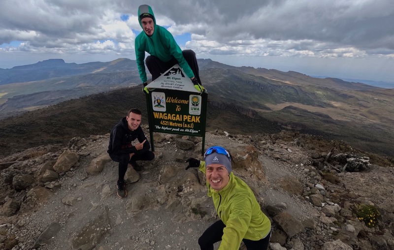 Wakagai Peak - highest summit of Mt. Elgon, 4321m above sea level.
Long trip to the trail head
The alarm was set for 5:00am. Milos, Tomas and I had a long day ahead of us. The day before we had found a local we could rent a boda boda/motorcycle from. Tomas has a little experience driving these from a trip earlier in Kenya. We managed to drive about 80m before it turned out that the tank was empty. It was still completely dark out, starry sky and Sunday. A bit of a problem that it was a Sunday, because this day people take the day off and go to church. So there were absolutely no people in the street. Some pushing of the boda boda and then the places it went a little downhill we could roll it. We were so lucky that we found someone we could wake up at a gas station in Kapchorwa, who could help us further.
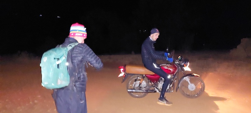 Ready for departure - while we could still ride it.
Just when we thought everything was running smoothly, we got a flat tire. We had covered about 15km of the total 60km ride. Milos and I jumped off the bike, while Tomas tried to continue with a flat rear tire. After walking for 45min we finally got to Tomas, who had found a person on the roadside near Sipi who could help us change the rear tire. We were incredibly lucky with that, we were convinced that the trip stopped there. And it only cost us only 25k Ugandan shillings.
Now we could finally continue. The last third of the trip was not on tarmac. Dirt roads that just got worse and worse! In the end it was almost impossible to get back and forth with the boda boda. It was now 8.45am and we could finally start the ascent - after more than 3 hours on the road.
Towards the top via the Sasa Trail
The "run" started from 1720m above sea level, so we were expecting a climb of over 2600m. We all had a small backpack with us, consisting of; some extra clothes, chapatis, bananas, a soda and some water. This was hopefully enough to keep us going all day. We had just over 21km ahead of us towards the summit. For every meter we moved forward there was less oxygen in the air - at sea level there is 20.9% oxygen in the air, while at the top there was 12% oxygen in the air.
The first part of the climb was really steep until we reached the jungle. From here it was actually a fairly easy climb and we were able to run part of the way. We had two short breaks along the way to eat something, otherwise we kept going pretty well. After almost 4 hours we reached the top. Pretty wild views from here over a large part of Kenya and Uganda.
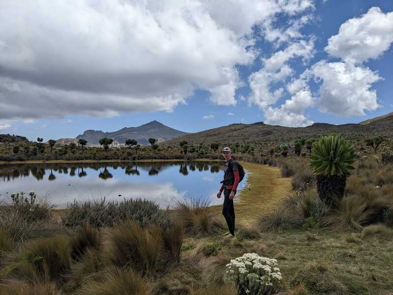 Pretty nice lake at about 4000 masl.
A couple of places we could find some spring from where we could refill our water bottles.
The trip home
Mt. Elgon is located in a large national park, where you need a permit. And it is mandatory to hire a guide (with a rifle) to accompany the group. A guide will not really be able to run. I only say maybe, that we had a permit and a guide.
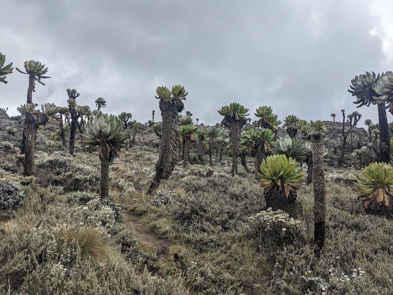 Spetacular landscape. This is not far from the summit.
Not everyone on the mountain was equally impressed with our achievement, so it ended up being a long trip home. But that's another story.
The trip in totals:
- 43.2k
- 2670m ascent
- 6h20m (without breaks)
- 1720m to 4321m elevation
- Route: Sasa Trails
See the route on Strava here.